Hikes Along the Hudson
The First Wilderness Heritage Corridor is all about the Hudson River. It was along the Hudson that Thomas Durant built his Adirondack Railroad, and its tracks -- originally laid from Saratoga Springs to North Creek between 1865 and 1871 -- are still ever-present along the river.
I'm always impressed by the Hudson's size below its junctures with the Schroon River in Warrensburg and, 40 miles downstream in Hadley, the Sacandaga. Many hikes in Warren County provide great views of the Hudson, but only a few will bring you right down to the water's edge. On the way to the First Wilderness from Exit 18 on the Northway, both the Hudson Pointe Nature Preserve and Leon M. Steves Big Bay Preserve will. They’re connected, providing an expansive riverside terrain to explore any time of year. Mud season is a good time since we’re supposed to be staying out of elevated areas and the Hudson is at its most swollen.
Hudson Pointe Nature Preserve
We have Queensbury Parks and Recreation to thank for these 83 acres on the banks of the Hudson, offering a 2.6-mile trail system. The virtually non-stop views of the river begin the moment you leave your car and walk 100 yards across a playing field and enter the woods. You'll find yourself on the bluff that contains the river, a few hundred yards from the hydroelectric dam at Sherman Island. Take a left and you’ll be on the Red Trail. In about a half-mile, the Green Trail will present itself, and I suggest you take it. As you’ll see on the map, it follows the perimeter of Hudson Pointe, presenting an outstanding 180-degree perspective of the river as it curves toward the “Big Bend.” This is where logs once floated by the millions on their way to the sawmills and paper mills of Glens Falls.
If you’re looking for a longer hike, the map is worth a close study. See especially the Blue Trail, which begins at the intersection of the Green and Red Trails. The Blue Trail is the connector to the Leon M Steves Big Bay Preserve, where more trails are available.
Click to enlarge

Going counter-clockwise on the Green Trail, you’ll be treated to this view of West Mountain and the Sherman Island hydroelectric dam.
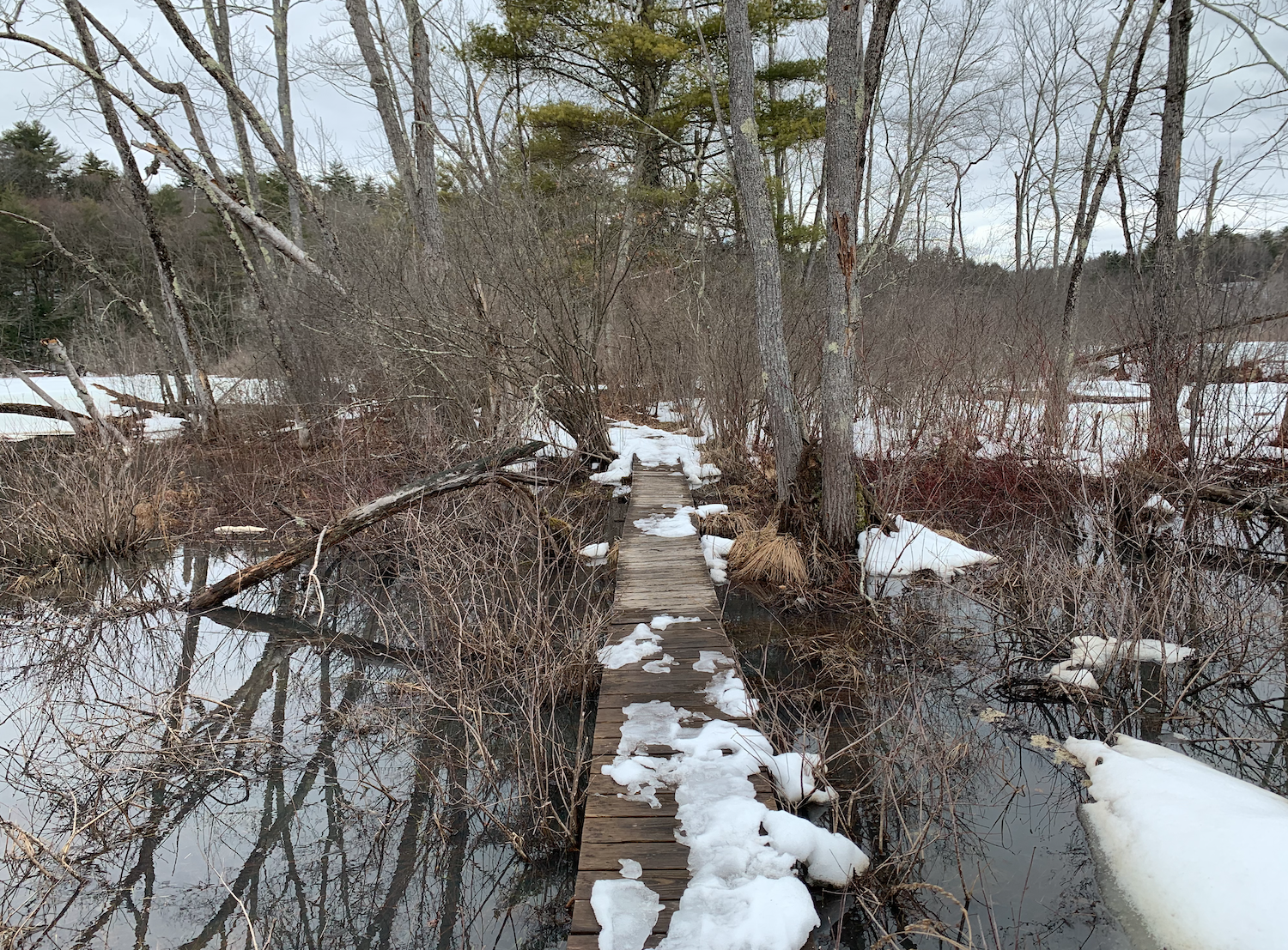
In past years, I’ve found this boardwalk flooded as the Hudson rises with the spring melt, but it was fine for now.
The boardwalk leads to this bridge. From here, it’s about a quarter-mile to the Steves Preserve connector.

Heading toward the Steves Preserve, the Blue Trail provides a panoramic view of Big Bay through the trees.

The Blue Trail will bring you to this bridge, which leads into the Steves Preserve.
Leon M. Steves Big Bay Preserve
What exactly is the “Big Bay”? We don’t hear a lot about it, and even Google won’t give you much more than the adjoining map. If you click the map to enlarge it, you’ll see Big Bay right off Hudson Pointe, leading into the “Big Bend” that precedes the city of Glens Falls and the ”Big Boom,” where sawmills and timber companies in 1849 built a series of stone piers and chain booms to corral and sort the logs that came down the river.
The 68 acres that make up the Steves Preserve were donated by the Open Space Institute to the Queensbury Land Conservancy in 2015, providing 2500 feet of shorefront on the Hudson and 3,000 feet along the winding Clendon Brook.
The 2.2 miles of trails here are not as clearly marked as the trails of Hudson Pointe and it’s easy to lose track of how to get back to the car. If you have AllTrails, download the interactive map; it will track your progress throughout the preserve. But also bring a compass, a flashlight, and a photo of the map below.
Click to enlarge
This map is easier to read than the black-and-white versions you’ll find posted on the trails.

To see Big Bay, take the Yellow Trail to the Red Trail, which will take you down to the river’s edge.
Prepare yourself for this bizarre sight: a birch tree growing out of another tree of a different species.
Here’s Big Bay from the Red Trail.

This is Clendon Brook.