At Last, an Ascent of Peaked Mountain
Here's where the trail to Peaked Mountain Brook, Peaked Mountain Pond, and Peaked Mountain begins.
Twice before in winter I had hiked to Peaked Mountain Pond in outings with the Crooked Canes. Both times, we ascended the trail with aim potentially of going not just to the pond but seven-tenths of a mile further and 600 feet higher to the peak’s rocky summit.
Especially in snowshoes, this last bit of hiking would be challenging. There were stretches, those who knew the trail said, where we would have to scramble, hauling ourselves up by seizing trees, roots, and rocks. Also concerning: the intensity of the chill that Arctic winds were generating.
”Another time,” we decided in both cases and returned to our cars without summiting.
During our current stretch of remarkably fine weather, I decided the time had finally arrived to tend to this bit of unfinished business and headed to western Warren County with friends Bill Walker and Dave Godette. It was a day that felt like a celebration of everything we love about this place: the crispness of fall in the air, the blaze of color in the trees, and the sense of adventure that comes with stepping into the wild. We strapped on our packs and set off, knowing that this would be a day to remember.
If you can get away, this is the best of all times to go.
We drove up the Northway from Saratoga. If you do the same, you may want to download to your smartphone the new app we call Explore Warren County, which along the entire 40 mile route from Big Bend to North River will bring you Brian Chevalier telling stories of 20 points of interest you’ll pass along the route. Playing banjo is John Kribs.
Select the First Wilderness Audio Tour and our 22 GPS-triggered narratives will start playing, one after another, exit by exit as you head up the Northway to the Warrensburg exit and continue on Route 28 until you reach the far northwest corner of Warren County. A left turn here on Thirteenth Lake Road will lead you five miles into the Siamese Ponds Wilderness to the start of the Peaked Mountain Trail. Take a right on Beach Road and drive two miles to the parking lot. No reservation is required.
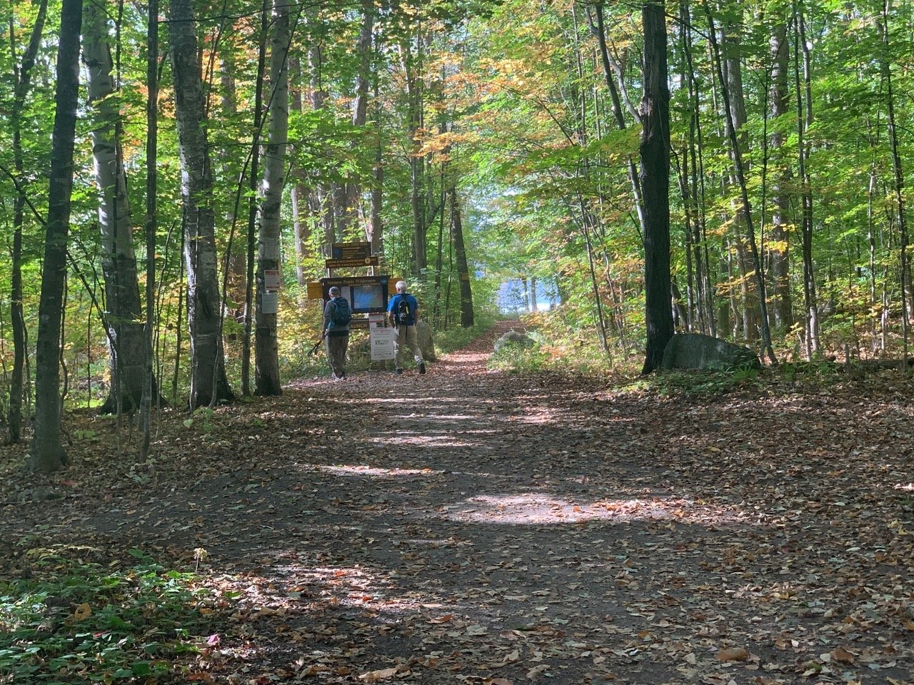
Following the same gravel path used by swimmers and kayakers, you’ll come to the trail register. Another hundred yards further on, you’ll come to the lake, where your hike will begin.

Follow the path that, veering right, will run nine-tenths of a mile along the lake’s western shore. At Peaked Mountain Brook, the trail to Peaked Mountain Pond will turn sharply right. It will be 2.1 miles to the pond from here.
For a longer hike that requires less elevation gain, you might some other day consider a journey that will take you to Hour Pond in 2.4 miles from here. Continue for 5.9 miles and you’ll come to Puffer Pond. For adventurous campers, the Siamese Ponds Wilderness offers remarkable opportunities. Around Thirteenth Lake alone are 17 campsites, most of which can be reached along this trail. We passed a half-dozen tents on our hike.
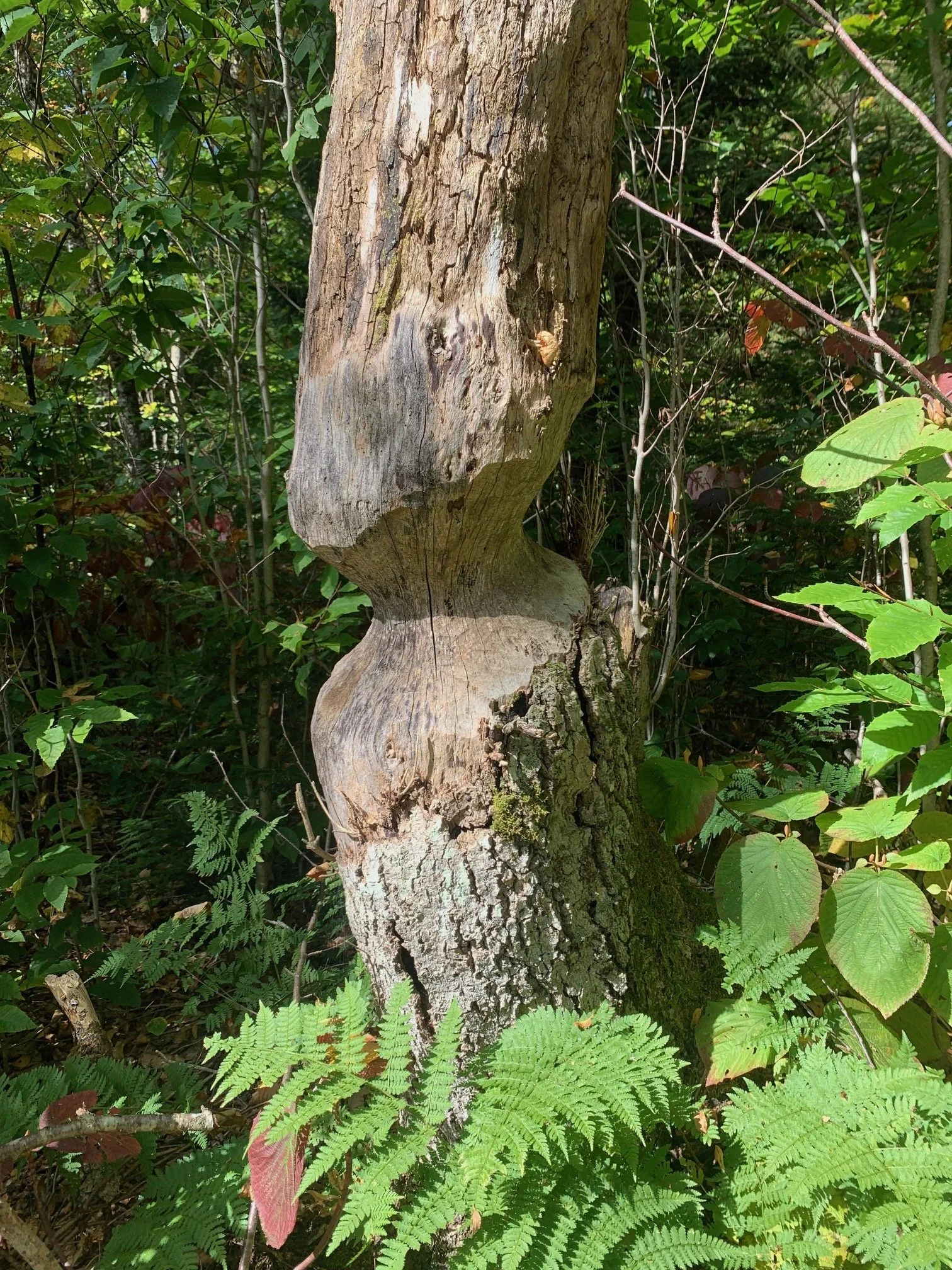
When you come to the clearing photographed above, you’ll know it’s time to start climbing. The trail between the lake and the pond will offer stretches of moderate steepness interspersed with flatness. Below is just a brief sampling of sights you are likely to come upon, which include an exceptional view of the summit looming over a beaver pond, a half-chewed tree trunk that beavers apparently gave up on, and immense erratics that make you wonder what it must have been like 20,000 years ago when the Laurentide Ice Sheet covered this region.


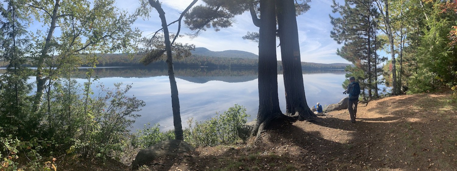
When you arrive at the Peaked Mountain Pond, you’ll find the trail continues along the eastern shore of the pond for another half mile. Keep going for the best view. Following a short path off the main trail, you’ll come to a part of the lake where the summit can easily be seen.

This is where you’ll need to decide whether or not to continue to the summit. In the photo below, Bill traverses the trail’s steepest part.
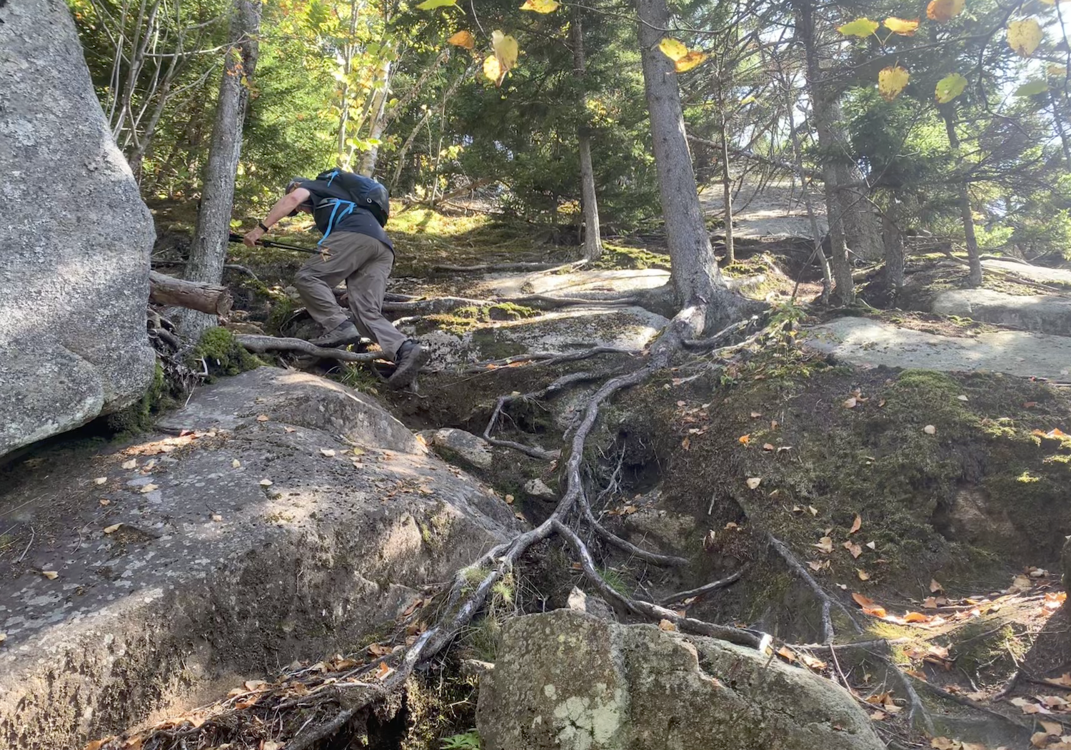
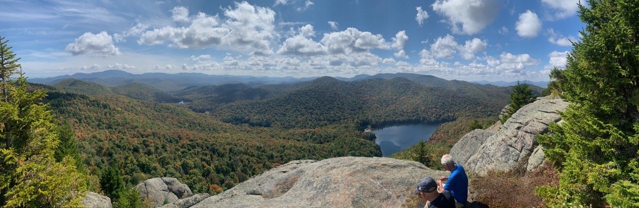
As tough as this steep stretch is, you’ll be glad you hung in and made the summit. What you’ll find there is this 180-degree vista looking south toward Gore Mountain, Height of Land Mountain, Crane Mountain, and Eleventh Mountain. Look carefully and you’ll see etched in the woods leading to Peaked Mountain Pond the trail you’ve followed to get here.

If You Go
Click on this map and trail description to download and print it. This is from the Warren County Recreation Mapper, an invaluable resource offered by the Warren County Department of Planning and Community Development.